Showing posts with label Forecasting. Show all posts

Wednesday, October 27, 2010

A look ahead, but what to believe?

For sure, one thing that has been learned over the past few years is that looking, simply, at a model run is not enough. One must look at the ensembles. The same model with little tweaks of data upon the initialization of the model run that allows for subtle changes and thus, different solutions. This will give you a better idea of what might happen by seeing where the bulk of the soltuions end up. But then, sometimes, like this example, who knows what to believe? This is a 204 hour solution of the GFS (about 8 1/2 days out) for North Ameria. On the left is the ensemble means (the average of all the possible solutions of this model.) The right shows the "spaghetti plot" which is to say it shows every model solution thus creating a thing that looks like spaghetti. The white line on the right is representative of the operational GFS model (one member of the ensembles.) The ensembles really don't agree well at all here and the GFS operational solution is an outlier! So, what will happen in 8.5 days? Your guess is as good as mine!!

Thank you to PSU's E-Wall for this set of images. The E-Wall (just google PSU E-Wall) is an awesome site!

Monday, October 25, 2010

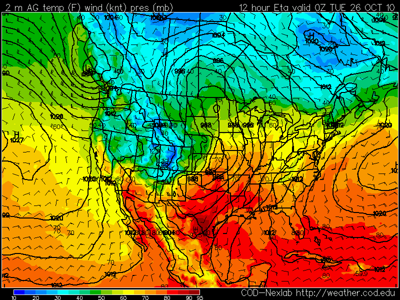
the final installment. At 12 hours away, WRF vs GFS


Clearly, even at 12 hours away, there are still differences but there is finally some continuity b/t the models. Now we shall see if either one of them are right at 00Z Tuesday (7pm, tonight). 

Meanwhile, this storm system will be something else. by 00Z Wednesday (7pm Tues Night), the surface low will have "bombed" with pressure falling to the low 960's in millibars. That's Cat-3 Hurricane type pressures!

More on that with upcoming blogs.

Hope you enjoyed the last 3 days of watching the models :)

Sunday, October 24, 2010

24 hours away, WRF vs GFS in an epic battle for who is right. :)


To know what this is..see my previous few blogs, but, we are 24 hours away from 00Z Tuesday now and the WRF and GFS still can't get along. Unreal. Like two stubborn young bothers and neither will give in!

36 hours away, can the WRF and GFS agree? Hmmmmm


The GFS has continually had the surface low near ND/SK/MB while the WRF has had the sfc low near KS. Here we are 36 hours away and we finally see some agreement. They now show *both* areas of low pressure, to some degree. Be sure to check the previous 4 posts on this thread to see the progression of both models. It has been interesting to see how they have come together. But, one can see that there are still plenty of differences in the details. 

On thing for sure, which I haven't mentioned, is that there *is* a monster storm coming into the northern/middle part of this country and into the Great Lakes. "Edmund Fitzgerald" type storm is a comin'!  I've been showing the models valid 00Z Tuesday (7pm Monday night) but a look at what is coming in the Monday-Wednesday time frame is rather amazing.  

Once we get to Tuesday, I'll show an analysis to see how the models really did and which one was correct, but also to show this major storm.